Protecting Peru’s peatlands

In an article published this month in the journal Conservation Biology members of the UKTPWG and colleagues identify and map threats to the recently-described intact peatlands of the Pastaza-Marañón Foreland Basin in north-east Peru. They highlight the need to protect these peatlands to avoid future degradation, and identify several key pathways for conservation.

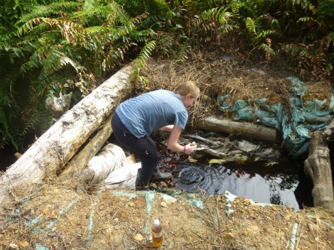
The Mauritia flexuosa palm at the site of Quistococha

The authors found that, in their case study area, the main threat to peatland health is the expansion of commercial agriculture linked to the development of new transport infrastructure, which makes it easier for companies to access remote areas.

Although some of the peatlands in the PMFB were found to fall within existing legally protected areas such as national parks, this protection is patchy, often weak, and not focused on protecting the most carbon-rich areas.

The article argues that conservation efforts should be focused in the first instance on the most carbon-rich peatlands, such as those north of the Marañón which currently lie entirely outside of the legally protected areas.

The paper’s authors are based in the School of Geography and Sustainable Development at the University of St Andrews (Roucoux, Lawson), the University of Leeds (Baker), University of Edinburgh (Mitchard), University of Reading (Kelly), Instituto de Investigacion de la Amazonía Peruana (del Castillo Torres, Honorio Coronado), Carnegie Institution for Science, Washington DC (Draper), Arizona State University (Lahteenoja), George Mason University (Gilmore), and the Field Museum, Chicago (Vriesendorp).

Link to the accepted manuscript: http://onlinelibrary.wiley.com/doi/10.1111/cobi.12925/full

An Interdisciplinary Project: Fish and the Importance of Fish(ing) to Human Communities in Sabangau, Indonesia

In this fortnight’s blog-post, Sara Thornton, a member of the UK TPWG and PhD student at the University of Leicester, gives us the low-down on her doctoral research, looking at fish diversity and much more, in the Sabangau peatlands of Indonesian Borneo.  Her important work is also captured by a set of beautiful photographs that she took whilst on fieldwork (see the press release images).

A family of fishers checking their catch on the Sabangau River. Photo by Sara Thornton

A family of fishers checking their catch on the Sabangau River. Photo by Sara Thornton

My PhD takes an interdisciplinary approach to understand the socio-ecological system of the Sabangau, Indonesian Borneo. In particular, I focus on the relationships between human fishing communities, nonhuman fish communities and other nonhuman aspects of the ecosystem (including abiotic aspects and spiritual nonhuman beings) and how these relationships lead to certain emergent properties (e.g. resilience). I also consider human perceptions of environmental change, and how fire, dams, human population growth and fishing diversification/intensification impact fishing and human livelihoods. To do this, I used the following methods:

  1. Surveys of fish communities and water quality in the Sabangau River and the Sabangau Forest
  2. Questionnaires, interviews and focus groups in two local communities: Kereng Bangkirai (situated near to the intact Sabangau peat-swamp forest) and Taruna Jaya (situated in an area of severely degraded peatland)
An unedited photo showing fishermen fishing on the Sabangau River during the catastrophic haze from forest and peatland fires in 2015. Photo by Sara Thornton

An unedited photo showing fishermen fishing on the Sabangau River during the haze from the forest and peatland fires in 2015. Photo by Sara Thornton.

Some notable results included:

  • A final fish species list of 54 species! Making Sabangau a notable area for peat-swamp forest fish diversity
With my research assistants, we trapped over 60,000 fish over a year of monthly fish surveys. Here one assistant measures the Standard Length of a Belontia hasselti. Photo by Sara Thorn

With my research assistants, we trapped over 60,000 fish over a year of monthly surveys. Here one assistant measures the Standard Length of a Belontia hasselti

  • With the water quality data (e.g. pH, water temperature, dissolved oxygen levels) I am able to recommend improvements for future fish sampling
  • The fish and water quality data provides a baseline for future monitoring
  • Fish was considered in both locations to be the most important nonhuman forest species to people’s lives. This is not surprising considering the economic importance that fish has locally, and that it is one of the main sources of protein:
    • I found the average annual fish consumption in Sabangau is nearly three times the global average!
Learning to make a traditional fish trap (Dudin on left and Sara on right), photo by Julie Lasne

Learning to make a traditional wire trap, tampirai, used for the fish surveys (Dudin on left and Sara on right). Photo by Julie Lasne.

  • The human communities expressed important cultural values, aesthetic and experiential values when discussing many of the nonhuman forest species (e.g. fish, orangutans, gibbons, hornbills). There were strong spiritual beliefs related to fish and the river in the Sabangau area
    • This included taboos related to eating or cooking certain fish species, the presence of various river and forest spiritual beings and the use of offerings to improve fish catches
    • These cultural perspectives are vital to include in considerations of values associated with ecosystems and biodiversity
    • Spiritual beliefs can play an important role in determining how some people in Sabangau relate to the river, to fish and thereby the ‘environment’

Lastly, while fish may not be the most charismatic of peat-swamp forest species like great-apes or felids, they provide one of the clearest faunal links between people, livelihoods and their ‘environment’ in the Sabangau. In areas with high dependence on fish for livelihoods, fish research and conservation projects could be a great opportunity to increase the relevance of environmental research to local communities and thereby potentially increasing local support for conservation projects.

The new TOC-loss-ometer!

This week, Sarah Cook, a member of the UK TPWG and PhD student at the University of Leicester, published an exciting paper documenting a new, low cost and easy-to-use methodology for measuring DOC losses from tropical peatlands.  Here she describes this important work.

My research is focused on investigating fluvial organic carbon (TOC) losses from tropical peatland oil palm plantations, within Southeast Asia. However, when I first started developing my research methodology I found limited guidance for analysing tropical TOC water samples. Tropical work is often undertaken in remote field sites with limited on-site laboratory facilities (if any), with any flat stable surface (i.e. the dinner table, car boot and concrete floors) quickly becoming a state of the art workbench. In addition, temperature also plays a significant role, with the hot sticky heat quickly degrading anything remotely organic. In my case this could mean the breakdown, and loss, of significant proportions of organic carbon from my water samples. This also meant the need to ship large, heavy and expensive boxes of samples back to the UK for analysis on specialised analytical equipment.

sarahcook1

Collection of fluvial organic carbon from an oil palm plantation drainage channel.

This prompted us to develop better guidance for tropical researchers for TOC analysis, and lead to the publication of a water storage paper (https://doi.org/10.19189/MaP.2016.OMB.249) in 2016 and a recent paper in Water Research (February, 2017; http://dx.doi.org/10.1016/j.watres.2017.02.059). In this most recent paper we investigated the suitability of UV-visible spectrometry to determine dissolved organic carbon (DOC) concentrations in tropical water samples, building on an original methodology developed by (Carter et al.2012; http://dx.doi.org/10.1016/j.watres.2012.05.021) on temperate peat. Overall UV-visible spectroscopy (using both a single and two-wavelength approach) was able to accurately predict tropical DOC concentrations. This offers research groups working in remote field locations the ability to rapidly analyse water samples post-collection, negating the need to store degradable samples for lengthy periods of time, helping improve spatial and temporal DOC measurements. In addition, the equipment required for this analysis can be set up at a field base, valuable for researchers in remote locations with limited access to specialised (and often expensive) analytical equipment. This in turn can help reduce the number of samples that need to be shipped back, further helping to reduce research costs. Full details of both papers can be found at:

https://doi.org/10.19189/MaP.2016.OMB.249

http://dx.doi.org/10.1016/j.watres.2017.02.059

sarahcook2

Graphical abstract from the Water Research paper, showing an example of a plantation drainage channel and predictive ability of the UV model.